

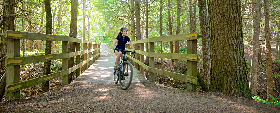
Explore an 18-km trail network on foot or bicycle

On Tuesday, April 28, 2026, from 7:00 am until 7:00 pm, the rail trail in Lower Truro, beginning near the Wastewater Treatment Plant and continuing approximately 1.5 km west toward Cobequid Bay Lookoff (towards Old Barns), will be closed while NS Agriculture conducts vegetation management. Signs and barricades will be in place. The dike trail at the Lookoff and the rail trail from the Lookoff to the Old Barns trailhead will be open. The Municipality apologizes for any inconvenience this closure may cause.
About the Trail
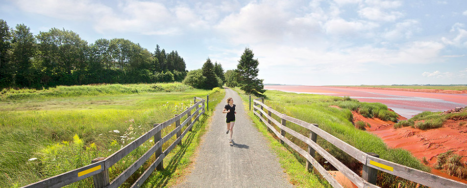
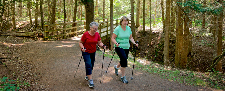
The Cobequid Trail is an 18-km walking and bicycling trail network in central Colchester County. Open year-round. No winter maintenance.
- Walking, cycling and snowshoeing are permitted.
- Motorized vehicles are prohibited.
- Dog on leash are permitted. Please pick up after your dog.
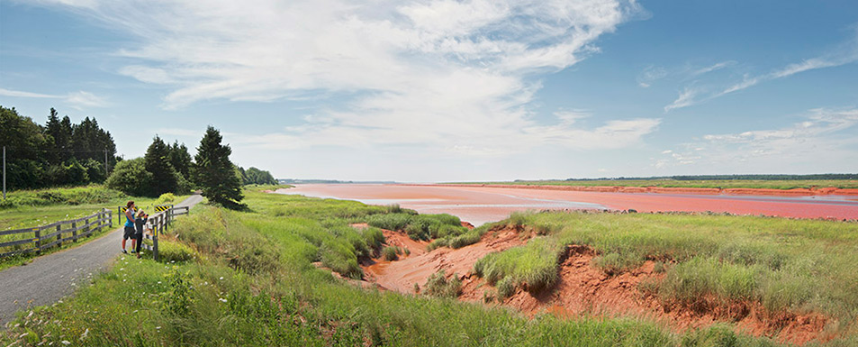
Explore woodland paths and shaded brooks. Follow the rail trail from Truro to Cobequid Bay. Watch for migratory birds on the marshlands and mudflats. View the Salmon River and salt marsh. Catch the tidal bore when it arrives twice daily. Discover the land “where the bay runs far up”.
pdf Cobequid Trail Map 2022(2.45 MB)
Access the trail at these trailheads
- Old Barns trailhead, 919 Shore Road, Old Barns
- Cobequid Bay Lookoff trailhead, 3471 Highway 236, Lower Truro
- Lower Truro trailhead, 4057 Highway 236, Lower Truro
- Fundy Discovery Site trailhead, 103 Tidal Bore Road, Lower Truro
- Will-Kare trailhead, 105 Lower Truro Road, Lower Truro
- Truro trailhead, 202 Willow Street, Truro
- Eagle Crest trailhead, 39 Warren Drive, Bible Hill
- Farnham Brook trailhead, 36 Village Court, Bible Hill
- Bible Hill Recreation Park trailhead, 38 Guest Drive, Bible Hill
The Old Barns, Lower Truro and Truro sections of the Cobequid Trail are part of the Blue Route and the Trans Canada Trail.

![]()